What is the Lowest Point In the State of Colorado?
We all know Colorado is high, but it seems we never talk about how low it is.
Colorado is the highest state in the nation, in more ways than one. For this discussion, however, I'm talking about elevation. Colorado has the highest mean elevation in the United States. It also boasts of the nation's highest low point. It's that low point I want to focus on.
So where exactly is the lowest point in Colorado?
A bit of deductive reasoning would lead us to think the state's lowest point would be east of the Rocky Mountains. That is logical, and these figures would illustrate that logic.
The elevations of three towns on the extreme western edge of Colorado; Rangely, Grand Junction, and Durango are 5,297; 4,583; and 6,522 respectively.
Meanwhile, on the extreme eastern edge of the state, you have towns like Julesburg, Burlington, and Lamar with an elevation of 3,478; 4,170; and 3,619 respectively.
The next bit of deductive reasoning would suggest that water runs downhill and the point where a river is leaving the state would be a good candidate for the state's lowest point. Once again, logical reasoning.
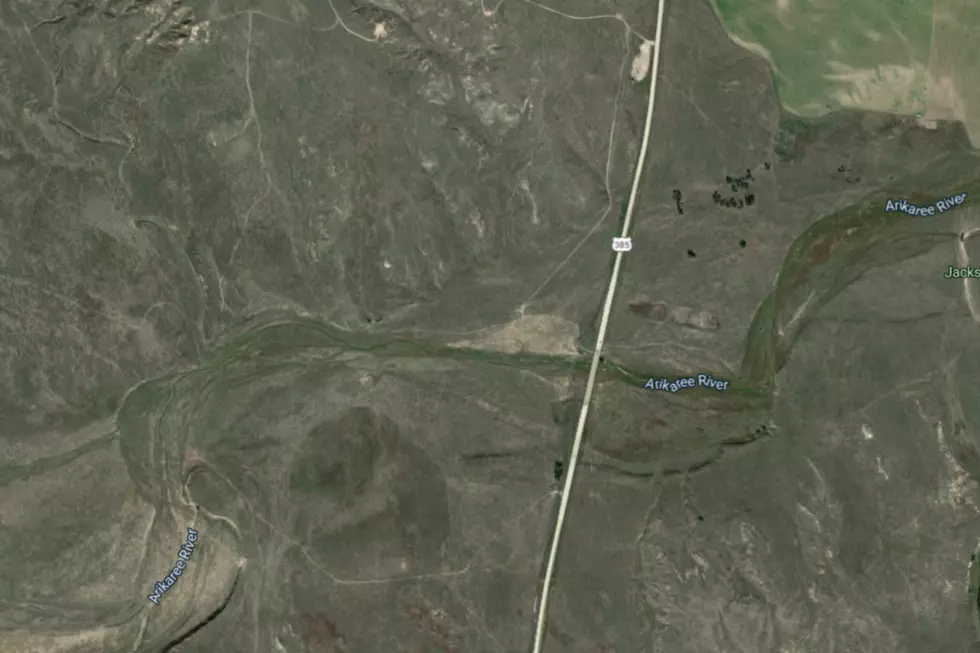
To narrow down the state's lowest point is a little complicated. According to Colorado Central Magazine, the lowest point in Colorado is 3,315 feet, where the Arikaree River flows into Kansas out of Yuma County. Not only is that the highest low point of any state in the country, but it's also higher than the highest point of 18 other states.
More From Mix 104.3